
- Afhalen na 1 uur in een winkel met voorraad
- Gratis thuislevering in België vanaf € 30
- Ruim aanbod met 7 miljoen producten
- Afhalen na 1 uur in een winkel met voorraad
- Gratis thuislevering in België vanaf € 30
- Ruim aanbod met 7 miljoen producten


Resultaten gefilterd op "National Geographic"
-
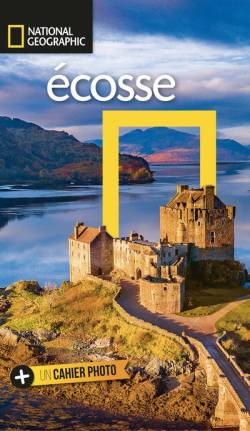
Ecosse
Robin McKelvie, Jenny McKelvie
- Paperback | Frans
- Écosse Des photographies sensationnelles, des cartes superbes et des textes qui font autorité. Tous les jours, des spécialistes du National Geographic... Lees meer
€ 20,05Levering 1 à 2 weken€ 20,05Levering 1 à 2 weken -
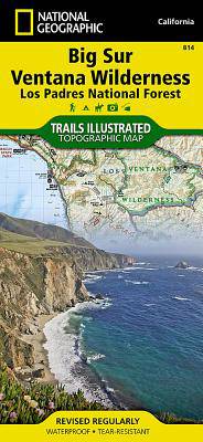
Big Sur / Ventana Wilderness /CA
- Gevouwen kaart | Engels
- National Geographic's Trails Illustrated map of Big Sur, Ventana Wilderness combines unmatched detail with helpful information to offer an invaluable ... Lees meer
€ 15,95Levering 1 à 2 weken€ 15,95Levering 1 à 2 weken -
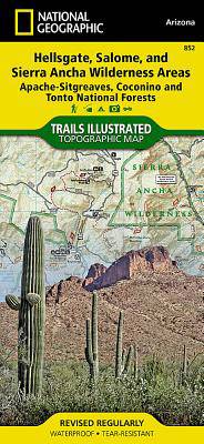
Hellsgate, Salome, Sierra Ancha Wilderness Areas /AZ
- Gevouwen kaart | Engels
- One of the largest national forests in the United States, Tonto National Forest is known not only for its diversity of terrain, flora and fauna but al... Lees meer
€ 15,95Levering 1 à 2 weken€ 15,95Levering 1 à 2 weken -
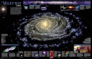
Melkweg wandkaart
- Opgerolde kaart | Engels
- This computer-generated image of the Milky Way shows the entire galaxy in one perspective of a 3-D model compiled specially for National Geographic. T... Lees meer
€ 24,50Levering 1 à 2 weken€ 24,50Levering 1 à 2 weken -
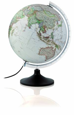
Globe carbon executive 30 cm NL
- Nederlands
- De verlichte National Geographic wereldbol/globe met carbon executive uitvoering geeft een prachtige gedetailleerde kaart weer, waarop meer dan 2000 N... Lees meer
€ 69,99Levering 1 à 2 weken Afhalen in de winkel na 1 u.€ 69,99Levering 1 à 2 weken Afhalen in de winkel na 1 u. -

Sicilië
- Gevouwen kaart | Engels
- Explore the vibrant history and rural beauty of the largest island in the Mediterranean Sea with National Geographic's Sicily Adventure Map. This expe... Lees meer
€ 15,95Levering 1 à 2 weken€ 15,95Levering 1 à 2 weken -

Sequoia & Kings Canyon NP
- Gevouwen kaart | Engels
- In Sequioa and Kings Canyon National Parks you can walk among the world's largest trees, hike the alpine landscape of the Sierra Crest, and marvel at ... Lees meer
€ 15,95Levering 1 à 2 weken€ 15,95Levering 1 à 2 weken -
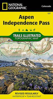
Aspen Independence Pass
- Gevouwen kaart | Engels
- National Geographic's Trails Illustrated map of Aspen and Independence Pass delivers unmatched detail and valuable information to assist you in your e... Lees meer
€ 15,95Levering 1 à 2 weken€ 15,95Levering 1 à 2 weken -
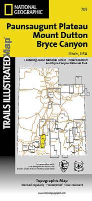
Mount Dutton - Aquarius Plateau
- Gevouwen kaart | Engels
- This map covers the spectacularly scenic stretch in southern Utah of the Powell and Escalante Ranger Districts of Dixie National Forest—from Bicknell ... Lees meer
€ 15,95Levering 1 à 2 weken€ 15,95Levering 1 à 2 weken -
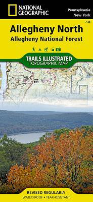
Allegheny North (Allegheny Nat. Forest)
- Gevouwen kaart | Engels
- National Geographic's Trails Illustrated map of Allegheny North delivers unmatched detail and valuable information to assist you in your exploration o... Lees meer
€ 15,95Levering 1 à 2 weken€ 15,95Levering 1 à 2 weken -
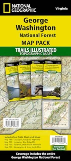
George Washington Nat. Forest Map Pack /VA
- Gevouwen kaart | Engels
- Explore the natural beauty, historical sites, and many recreation opportunities available in southern Virginia with National Geographic's Trails Illus... Lees meer
€ 49,95Levering 1 à 2 weken€ 49,95Levering 1 à 2 weken -

Jasper North - Jasper NP
- Gevouwen kaart | Engels
- The largest park in the Canadian Rockies, Jasper National Park is a UNESCO World Heritage Site with breathtaking mountain scenery and bountiful recrea... Lees meer
€ 15,95Levering 1 à 2 weken€ 15,95Levering 1 à 2 weken -
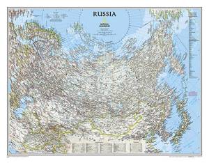
Rusland wandkaart geplastificeerd
- Opgerolde kaart | Engels
- National Geographic's political map of Russia and the independent states of the former Soviet Union is one of the most authoritative maps of region. T... Lees meer
€ 27,95Levering 1 à 2 weken€ 27,95Levering 1 à 2 weken -
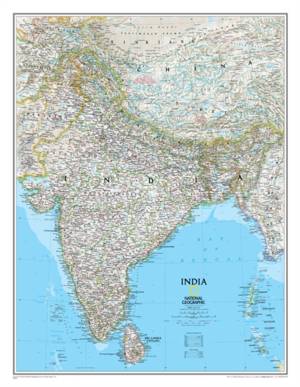
India wandkaart
- Opgerolde kaart | Engels
- As attractive as it is functional, National Geographic's Classic style political map of India is one of the most detailed and comprehensive maps ever ... Lees meer
€ 21,95Levering 1 à 2 weken€ 21,95Levering 1 à 2 weken -
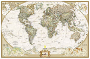
World politiek antiek groot wandkaart geplastificeerd
- Opgerolde kaart | Engels
- The Executive style World map uses an antique-style color palette and stunning shaded relief that provide a richness perfect for any decor. Drawn in t... Lees meer
€ 59,95Levering 1 à 2 weken Afhalen in de winkel na 1 u.€ 59,95Levering 1 à 2 weken Afhalen in de winkel na 1 u. -

Toscane
- Gevouwen kaart | Engels
- Rolling plains, picturesque mountains, sunny beaches, and architectural masterpieces attract scores of tourists each year who seek to experience first... Lees meer
€ 15,95Levering 1 à 2 weken€ 15,95Levering 1 à 2 weken -
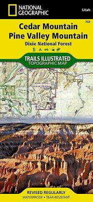
Cedar Mountain - Asdown Gorge
- Gevouwen kaart | Engels
- Cedar City is the headquarters of the Dixie National Forest which is a two-million-acre, 170-mile stretch of breathtaking wilderness across southern U... Lees meer
€ 15,95Levering 1 à 2 weken€ 15,95Levering 1 à 2 weken -
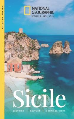
Sicile
Tim Jepson
- Paperback | Frans
- Sicile Des photographies inspirantes Des cartes claires et détaillées Des textes qui font autorité Des infos pratiques indispensables Tous les jours, ... Lees meer
€ 17,05Levering 1 à 2 weken€ 17,05Levering 1 à 2 weken -
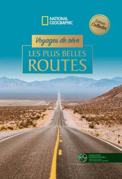
Voyages de rêve
- Hardcover | Frans
- Voyages de rêve Les plus belles routes De la mythique Route 66 à la Panaméricaine, des routes de Calabre en Italie à la route de la Soie, des routes d... Lees meer
€ 30,10Levering 1 à 2 weken€ 30,10Levering 1 à 2 weken -
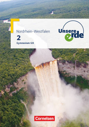
Unsere Erde - Gymnasium Nordrhein-Westfalen G9 - Ausgabe ab 2019 - Band 2
- Paperback | Duits | Unsere Erde
- Das Schulbuch im Überblick Zum G9 in Nordrhein-Westfalen: alle Unterrichtsinhalte zum neuen Kernlehrplan in einer spannenden Zusammenstellung von Dars... Lees meer
€ 35,45Levering 1 à 4 weken€ 35,45Levering 1 à 4 weken -
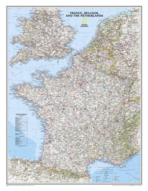
Frankrijk / België / Nederland wandkaart
- Opgerolde kaart | Engels
- National Geographic's Classic style political map of France, Belgium, and The Netherlands features clearly defined international boundaries, thousands... Lees meer
€ 14,95Levering 1 à 2 weken€ 14,95Levering 1 à 2 weken -

USA Zuidwest
- Gevouwen kaart | Engels
- There are few nations as vast and spectacularly diverse as the United States of America. From the Atlantic to the Pacific, "America the Beautiful" off... Lees meer
€ 15,95Levering 1 à 2 weken€ 15,95Levering 1 à 2 weken -
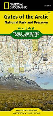
Gates of the Arctic National Park
- Gevouwen kaart | Engels
- Let National Geographic's Trails Illustrated map for Gates of the Arctic National Park and Preserve guide you on your adventure in this remote wildern... Lees meer
€ 15,95Levering 1 à 2 weken€ 15,95Levering 1 à 2 weken -
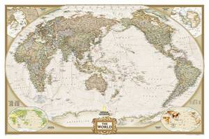
World politiek antiek Pacific centered wandkaart geplastificeerd
- Opgerolde kaart | Engels
- National Geographic's World map is the standard by which all other reference maps are measured. The World map is meticulously researched and adheres t... Lees meer
€ 31,95Levering 1 à 2 weken€ 31,95Levering 1 à 2 weken