Je cadeautjes zeker op tijd in huis hebben voor de feestdagen? Kom langs in onze winkels en vind het perfecte geschenk!
- Afhalen na 1 uur in een winkel met voorraad
- Gratis thuislevering in België vanaf € 30
- Ruim aanbod met 7 miljoen producten
Je cadeautjes zeker op tijd in huis hebben voor de feestdagen? Kom langs in onze winkels en vind het perfecte geschenk!
- Afhalen na 1 uur in een winkel met voorraad
- Gratis thuislevering in België vanaf € 30
- Ruim aanbod met 7 miljoen producten
Zoeken
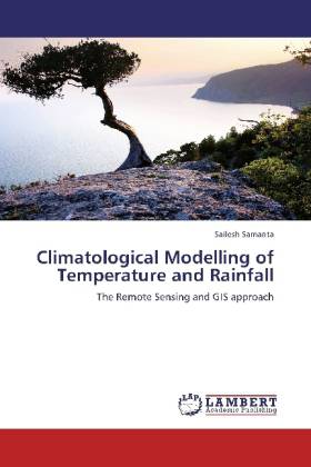
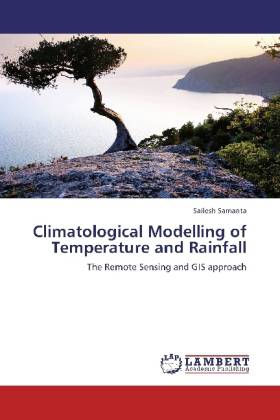
Climatological Modelling of Temperature and Rainfall
The Remote Sensing and GIS approach
Sailesh Samanta
Paperback | Engels
€ 78,45
+ 156 punten
Omschrijving
Agriculture in India is the means of livelihood of almost two thirds of the work force in the country. Although in terms of its share to India s GDP it ranks third, yet it has always been India s most important economic sector in terms food security and job creation. Climate and agriculture are interrelated entities, both having global implications. Many disciplines use these climate variables as a basis to understand the processes they study. Evidently the information is limited to the available meteorological stations and therefore to discrete points of the space. To understand the weather and climatic condition over a continuous space (where weather or climate station is not present) one needs to resort to the modern techniques like spatial interpolation by Geographic Information System (GIS). This work attempts to develop statistical model to forecast temperature and precipitation in Gangetic West Bengal and its neighborhood, where a number of weather systems occur throughout the year based on different dependent and independent variables derived from Remote Sensing and other sources. The model output and the standard error raster matrixes are used to build final maps.
Specificaties
Betrokkenen
- Auteur(s):
- Uitgeverij:
Inhoud
- Aantal bladzijden:
- 156
- Taal:
- Engels
Eigenschappen
- Productcode (EAN):
- 9783846594049
- Verschijningsdatum:
- 26/12/2012
- Uitvoering:
- Paperback
- Afmetingen:
- 150 mm x 220 mm
- Gewicht:
- 236 g

Alleen bij Standaard Boekhandel
+ 156 punten op je klantenkaart van Standaard Boekhandel
Beoordelingen
We publiceren alleen reviews die voldoen aan de voorwaarden voor reviews. Bekijk onze voorwaarden voor reviews.


