
Je cadeautjes zeker op tijd in huis hebben voor de feestdagen? Kom langs in onze winkels en vind het perfecte geschenk!
- Afhalen na 1 uur in een winkel met voorraad
- Gratis thuislevering in België vanaf € 30
- Ruim aanbod met 7 miljoen producten
Je cadeautjes zeker op tijd in huis hebben voor de feestdagen? Kom langs in onze winkels en vind het perfecte geschenk!
- Afhalen na 1 uur in een winkel met voorraad
- Gratis thuislevering in België vanaf € 30
- Ruim aanbod met 7 miljoen producten


Omschrijving
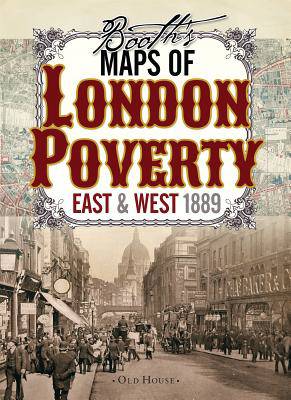
Two maps of Victorian London colored street by street show the lifestyle of the inhabitants from the wealthy upper classes to the vicious and semi-criminal lowest class. These two maps classify London streets into seven categories from the very poor lowest class mainly in the east end (but with some surprising enclaves in the fashionable west) right up to the wealthy upper classes in Marylebone and Mayfair. A fascinating resource for genealogists and all lovers of London's past.
Charles Booth was appalled by conditions in London's docklands and vowed to do something about it. Realising that the situation needed to be accurately assessed he published numerous surveys that reported on the living conditions, lifestyle and income of Londoners.
Charles Booth was appalled by conditions in London's docklands and vowed to do something about it. Realising that the situation needed to be accurately assessed he published numerous surveys that reported on the living conditions, lifestyle and income of Londoners.
Specificaties
Betrokkenen
- Auteur(s):
- Uitgeverij:
Inhoud
- Aantal bladzijden:
- 2
- Taal:
- Engels
- Reeks:
Eigenschappen
- Productcode (EAN):
- 9781908402806
- Verschijningsdatum:
- 18/11/2014
- Afmetingen:
- 147 mm x 208 mm
- Gewicht:
- 199 g


Alleen bij Standaard Boekhandel
+ 36 punten op je klantenkaart van Standaard Boekhandel
CADEAU


Beoordelingen
We publiceren alleen reviews die voldoen aan de voorwaarden voor reviews. Bekijk onze voorwaarden voor reviews.