
- Afhalen na 1 uur in een winkel met voorraad
- Gratis thuislevering in België vanaf € 30
- Ruim aanbod met 7 miljoen producten
- Afhalen na 1 uur in een winkel met voorraad
- Gratis thuislevering in België vanaf € 30
- Ruim aanbod met 7 miljoen producten


Omschrijving
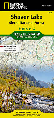
National Geographic's Trails Illustrated map of Shaver Lake will help all outdoor enthusiasts navigate their way off the beaten path and back again, around this very popular area of Sierra National Forest between Yosemite National Park and Sequoia National Forest. Clearly marked trailheads will point you to trails that are colored according to their designated usage and have mileage markers between intersections, including National Recreation trails like Columns of the Giants, Rancheria Falls and Lewis Creek Trail. The Kings Wild and Scenic River is also clearly shown along with a river difficulty scale chart, for whitewater rafting. Some of the other recreation features on the map are boat launch and river access points, ski areas, horse stables and scenic views.
Specificaties
Betrokkenen
- Uitgeverij:
Inhoud
- Taal:
- Engels
- Reeks:
Eigenschappen
- Productcode (EAN):
- 9781566952422
- Verschijningsdatum:
- 01/01/2008
- Uitvoering:
- Gevouwen kaart
- Formaat:
- Gelamineerd
- Afmetingen:
- 10 cm x 19 cm
- Gewicht:
- 92 g


Alleen bij Standaard Boekhandel
+ 31 punten op je klantenkaart van Standaard Boekhandel
CADEAU

AANGERADEN


Beoordelingen
We publiceren alleen reviews die voldoen aan de voorwaarden voor reviews. Bekijk onze voorwaarden voor reviews.