
- Afhalen na 1 uur in een winkel met voorraad
- Gratis thuislevering in België vanaf € 30
- Ruim aanbod met 7 miljoen producten
- Afhalen na 1 uur in een winkel met voorraad
- Gratis thuislevering in België vanaf € 30
- Ruim aanbod met 7 miljoen producten


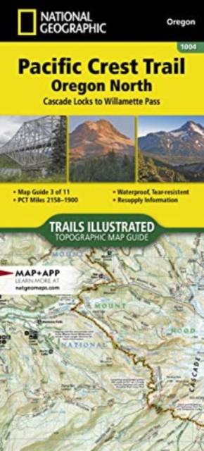
Pacific Crest Trail: Oregon North Map [Cascade Locks to Willamette Pass]
Topographic Map Guide
Engels
€ 20,95
+ 41 punten
Omschrijving
- Waterproof - Tear-Resistant - Topographic Map
The Oregon North Topographic Map Guide follows the Pacific Crest Trail (PCT) as it passes through a land of contrasts. After crossing the Columbia River, the trail quickly climbs out of the Columbia River Gorge and settles into a pattern of skirting the enormous cone-shaped stratovolcanoes of the central Cascades. Some, like Mount Hood, are glacier-covered, others like Three Fingered Jack, have craggy tops carved by now melted glaciers. This section of the PCT primarily traverses remote forests with much of the travel in wilderness areas. Highlights of this section include the Columbia River Gorge National Scenic Area and the Mark O. Hatfield, Mount Hood, Mount Jefferson, Mount Washington, and Three Sisters wilderness areas.
The PCT spans 2,650 miles from the Canadian border, through Washington, Oregon, and California to the southern terminus at the Mexican border. The famous trail crosses some of the most wild and scenic landscapes of the western U.S., including six national parks, 25 national forests, 48 wilderness areas, the volcanic Cascade Range of the Pacific Northwest, the snowcapped Sierra Nevada, and the Mojave and Sonoran deserts.
Each PCT Topographic Map Guide includes detailed topographic maps at a scale of almost 1 inch = 1 mile. Each page is centered on the PCT and overlaps with the adjacent pages so there is little chance of getting lost. Along the bottom of each page is a trail profile that shows the distance between camping areas, trailheads, and other points of interest. The map and trail profile provide a step by step visual guide to hiking the trail, mile by rugged mile. The Topographic Map Guide is built for all levels of hiking enthusiasts, from the day tripper to the multi month 'thru-hiker'. The front pages of the printed Topographic Map Guide include resupply locations, health and safety information, and much more.
More convenient and easier to use than folded maps, but just as compact and lightweight, National Geographic's Topographic Map Guide booklets are printed on "Backcountry Tough" waterproof, tear-resistant paper with stainless steel staples. A full UTM grid is printed on the map to aid with GPS navigation.
- Map Scale = 1:75,000
- Folded Size = 4.25" x 9.38"
Specificaties
Betrokkenen
- Auteur(s):
- Uitgeverij:
Inhoud
- Aantal bladzijden:
- 48
- Taal:
- Engels
- Reeks:
- Reeksnummer:
- nr. 1004
Eigenschappen
- Productcode (EAN):
- 9781566957106
- Verschijningsdatum:
- 1/01/2023
- Afmetingen:
- 107 mm x 234 mm
- Gewicht:
- 90 g


Alleen bij Standaard Boekhandel
+ 41 punten op je klantenkaart van Standaard Boekhandel
ACTIE

E-BOOK ACTIE


Beoordelingen
We publiceren alleen reviews die voldoen aan de voorwaarden voor reviews. Bekijk onze voorwaarden voor reviews.