
- Afhalen na 1 uur in een winkel met voorraad
- Gratis thuislevering in België vanaf € 30
- Ruim aanbod met 7 miljoen producten
- Afhalen na 1 uur in een winkel met voorraad
- Gratis thuislevering in België vanaf € 30
- Ruim aanbod met 7 miljoen producten


€ 11,95
+ 23 punten
Omschrijving
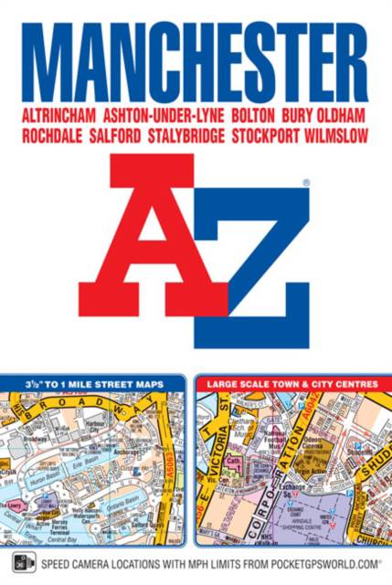
This A-Z map of Manchester includes coverage of: -Manchester-Altrincham-Ashton-under-Lyne-Bolton-Bury-Oldham-Rochdale-Salford-StockportThe paperback book includes 162 pages of continuous street mapping extending to include coverage of: -Cheadle-Heywood-Hyde-Irlam-Manchester Airport-Poynton-Prestwich-Radcliffe-Ramsbottom-Stalybridge-Swinton-Urmston-WilmslowThere are also large scale city and town centre maps of Manchester, Altrincham, Ashton-under-Lyne, Bolton, Bury, Oldham, Rochdale and Stockport and a postcode map.Postcode districts, one-way streets, safety camera locations with speed limits and National Park boundaries are also featured on the mapping.The index section lists streets; selected flats, walkways and places of interest; place and area names; National Rail and Metrolink stations. There is a separate list of hospitals, hospices and NHS Walk-in Centres covered by the atlas.An easy to follow map of the Manchester Metrolink is featured on the back cover.
Specificaties
Betrokkenen
- Auteur(s):
- Uitgeverij:
Inhoud
- Aantal bladzijden:
- 384
- Taal:
- Engels
Eigenschappen
- Productcode (EAN):
- 9781782571056
- Verschijningsdatum:
- 5/01/2017
- Uitvoering:
- Paperback
- Formaat:
- Trade paperback (VS)
- Afmetingen:
- 130 mm x 192 mm
- Gewicht:
- 456 g


Alleen bij Standaard Boekhandel
+ 23 punten op je klantenkaart van Standaard Boekhandel
Cadeau

AANGERADEN


Beoordelingen
We publiceren alleen reviews die voldoen aan de voorwaarden voor reviews. Bekijk onze voorwaarden voor reviews.