
- Afhalen na 1 uur in een winkel met voorraad
- Gratis thuislevering in België vanaf € 30
- Ruim aanbod met 7 miljoen producten
- Afhalen na 1 uur in een winkel met voorraad
- Gratis thuislevering in België vanaf € 30
- Ruim aanbod met 7 miljoen producten


Boeken geschreven door Collins Maps

-
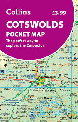
Cotswolds Pocket Map
- Gevouwen kaart
- Disover new places with handy pocket maps from Collins. Lees meer
€ 5,95€ 5,95 -
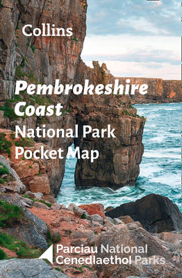
Pembrokeshire Coast National Park Pocket Map
National Parks Uk, Collins Maps
- Hardcover | Engels
- Handy little full colour map of Pembrokeshire Coast National Park. Detailed mapping and visitor information to the National Park along with a selectio... Lees meer
€ 5,95€ 5,95 -
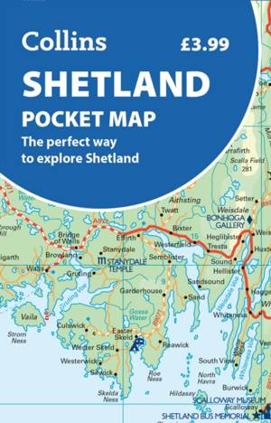
Shetland Pocket Map
- Gevouwen kaart | Engels
- Discover new places with handy pocket maps from Collins. Lees meer
€ 5,95€ 5,95 -
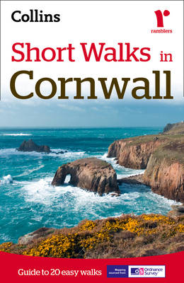
Short Walks in Cornwall
Collins Maps
- Paperback | Engels
- A practical guide to walks that can easily be completed in less that 3 hours This compact little guide contains 20 walks, all of which are five miles ... Lees meer
€ 9,95€ 9,95 -
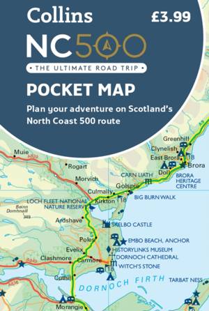
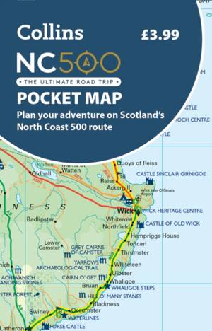
NC500 Pocket Map
- Gevouwen kaart
- Explore new places with handy pocket maps from Collins. Handy little full colour map of the popular North Coast 500 route. A perfect guide for travell... Lees meer
€ 6,95€ 6,95 -
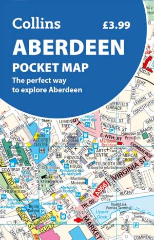
Aberdeen Pocket Map
- Gevouwen kaart
- Handy little full colour Collins map of Aberdeen with a high level of detail. Clear mapping of the central area extending to the airport and along the... Lees meer
€ 5,95€ 5,95 -
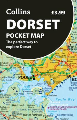
Dorset Pocket Map
- Gevouwen kaart
- Discover new places with handy pocket maps from Collins. Lees meer
€ 5,95€ 5,95 -
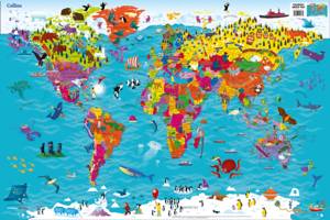
Collins Children's World Map
Collins Maps
- CD
- Colourful Illustrated Map of the World Lees meer
€ 6,95€ 6,95 -
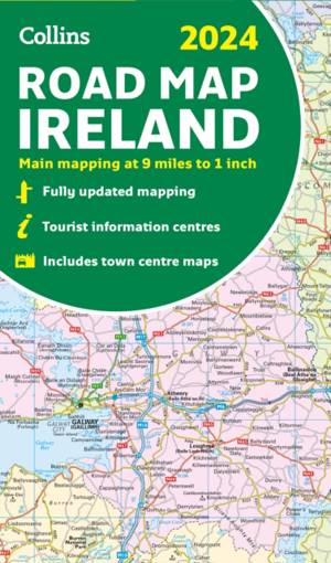
2024 Collins Road Map of Ireland
- Gevouwen kaart
- Discover new places with fully updated road atlases from Collins. Full-colour map of Ireland at 9 miles to 1 inch (1:570,240), with clear, detailed ro... Lees meer
€ 11,95€ 11,95 -

Dublin Pocket Map
- Gevouwen kaart
- Discover new places in Dublin with this handy pocket map from Collins. Lees meer
€ 5,95€ 5,95 -
Nc500 Pocket Map
- Gevouwen kaart | Engels
- Explore new places with handy pocket maps from Collins. Lees meer
€ 5,95€ 5,95 -
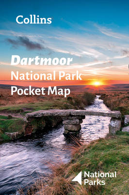
Dartmoor National Park Pocket Map
National Parks Uk, Collins Maps
- Hardcover | Engels
- Handy little full colour map of Dartmoor National Park. Detailed mapping and visitor information to the National Park along with a selection of photog... Lees meer
€ 5,95€ 5,95 -

Castles Map of Scotland
- Gevouwen kaart
- Discover Scotland's ancient monuments and castles. Explore Scotland’s ancient monuments with this pictorial map featuring over 700 castles and fortifi... Lees meer
€ 11,45€ 11,45 -
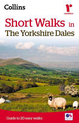
Short walks in the Yorkshire Dales
Collins Maps, Brian Spencer
- Paperback
- The Yorkshire Dales with its picturesque dales, ancient farmhouses and villages offer some superb country walking.This can be explored with these 20 w... Lees meer
€ 9,95€ 9,95 -
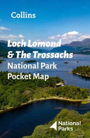
Loch Lomond and The Trossachs National Park Pocket Map
- Gevouwen kaart
- Explore the National Parks with this handy pocket map. Handy little full colour map and guide of Loch Lomond National Park. Detailed mapping and visit... Lees meer
€ 5,95€ 5,95 -

Wild Atlantic Way Pocket Map
- Gevouwen kaart | Engels
- Explore new places with handy pocket maps from Collins. Handy full-color map of Ireland's Wild Atlantic Way with a high level of detail. Clear mapping... Lees meer
€ 5,95€ 5,95 -
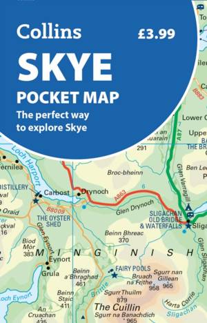
Skye Pocket Map
- Gevouwen kaart
- Discover new places with handy pocket maps from Collins. Lees meer
€ 5,95€ 5,95 -
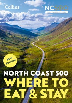
North Coast 500
Collins Maps
- Paperback | Engels
- A guide to the best places to enjoy the local Scottish cuisine and where to rest for the night along the famous North Coast 500. Elemental, enchanting... Lees meer
€ 20,95€ 20,95 -
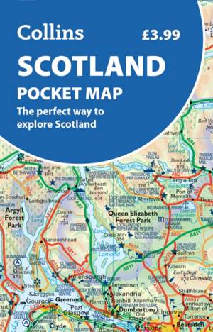
Scotland Pocket Map
- Gevouwen kaart
- Discover new places with handy pocket maps from Collins. Lees meer
€ 5,95€ 5,95 -
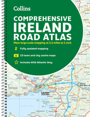
Comprehensive Road Atlas Ireland
Collins Maps
- Met spiraalrug | Engels
- A clear, detailed road atlas of Ireland in a handy A4 spiral-bound format. This comprehensive, general purpose road atlas of the whole of Ireland is i... Lees meer
€ 13,95€ 13,95 -
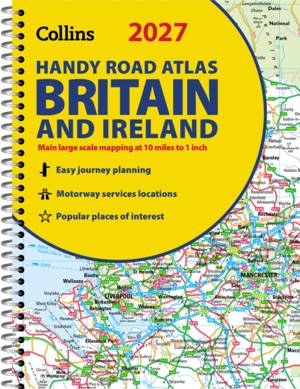
Collins Handy Road Atlas Britain and Ireland 2027 (A5 Spiral)
Collins Maps
- Met spiraalrug | Collins Road Atlas
- Explore Britain with easy-to-read mapping from Collins. Lees meer
€ 8,45€ 8,45 -
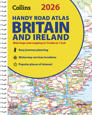
2026 Collins Handy Road Atlas Britain and Ireland
Collins Maps
- Met spiraalrug | Collins Road Atlas
- Explore Britain with easy-to-read mapping from Collins. Lees meer
€ 10,45€ 10,45 -

Collins 2026 Big Road Atlas Europe
Collins Maps
- Boek | Engels
- With fully-updated, large-scale mapping, there has never been an easier way to explore Europe by road. Lees meer
€ 20,95€ 20,95 -
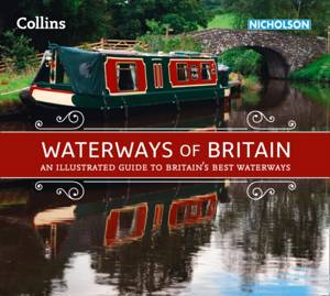
Waterways of Britain
Collins Maps
- Paperback | Collins Nicholson Waterways Guides
- Exploring Britain's most beautiful waterways. Discover a hidden countryside which is packed with wildlife along with industrial heritage. Lees meer
€ 23,95€ 23,95