
Je cadeautjes zeker op tijd in huis hebben voor de feestdagen? Kom langs in onze winkels en vind het perfecte geschenk!
- Afhalen na 1 uur in een winkel met voorraad
- Gratis thuislevering in België vanaf € 30
- Ruim aanbod met 7 miljoen producten
Je cadeautjes zeker op tijd in huis hebben voor de feestdagen? Kom langs in onze winkels en vind het perfecte geschenk!
- Afhalen na 1 uur in een winkel met voorraad
- Gratis thuislevering in België vanaf € 30
- Ruim aanbod met 7 miljoen producten


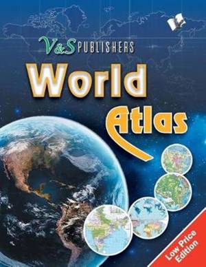
World Atlas
Government Approved Maps of India and the World, for Exams & Competitions, in Colour
V&s Editorial Board
Paperback | Engels
€ 24,45
+ 48 punten
Omschrijving
This atlas contains clear and easy to understand physical and political maps of India, continents, regions and important countries of the world supported by diagrams and charts. The atlas carries extensive coverage of thematic issues such as industry, mineral, agriculture, natural vegetation, climate, power, rail, road, air & sea routes, tourism, heritage, temperature & pressure, environments, whether, human development, metal & non metal, and other important information. Demographic and socio-economic data of India drawn from reliable sources such as Census of India 2011, Statistical Year Book India 2014. Information about the world from authoritative published sources. Comprehensive thematic maps on Indian agriculture & irrigation, food & cash crops, climate, rain, temperature, pressure & winds, metals & non-metals, mining, fuel, industries, transport and other important demographic information Key information and data about countries of the world and world statistics #v&spublishers
Specificaties
Betrokkenen
- Auteur(s):
- Uitgeverij:
Inhoud
- Aantal bladzijden:
- 138
- Taal:
- Engels
Eigenschappen
- Productcode (EAN):
- 9789357941495
- Verschijningsdatum:
- 3/03/2017
- Uitvoering:
- Paperback
- Formaat:
- Trade paperback (VS)
- Afmetingen:
- 216 mm x 279 mm
- Gewicht:
- 335 g


Alleen bij Standaard Boekhandel
+ 48 punten op je klantenkaart van Standaard Boekhandel
CADEAU


Beoordelingen
We publiceren alleen reviews die voldoen aan de voorwaarden voor reviews. Bekijk onze voorwaarden voor reviews.