
- Afhalen na 1 uur in een winkel met voorraad
- Gratis thuislevering in België vanaf € 30
- Ruim aanbod met 7 miljoen producten
- Afhalen na 1 uur in een winkel met voorraad
- Gratis thuislevering in België vanaf € 30
- Ruim aanbod met 7 miljoen producten


Whither the Waters E-BOOK
Mapping the Great Basin from Bernardo de Miera to John C. Frémont
John L. Kessell
E-book | Engels
€ 26,83
+ 26 punten
Uitvoering
Omschrijving
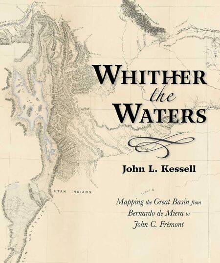
Bernardo de Miera y Pacheco (1713–1785) is remembered today not only as colonial New Mexico’s preeminent religious artist, but also as the cartographer who drew some of the most important early maps of the American West. His “Plano Geographico” of the Colorado Plateau and Great Basin, revised by his hand in 1778, influenced other mapmakers for almost a century. This book places the man and the map in historical context, reminding readers of the enduring significance of Miera y Pacheco. Later Spanish cartographers, as well as Baron Alexander von Humboldt, Captain Zebulon Montgomery Pike, and Henry Schenck Tanner, projected or expanded upon the Santa Fe cartographer’s imagery. By so doing, they perpetuated Miera y Pacheco’s most notable hydrographic misinterpretations. Not until almost seventy years after Miera did John Charles Frémont take the field and see for himself whither the waters ran and whither they didn’t.
Specificaties
Betrokkenen
- Auteur(s):
- Uitgeverij:
Inhoud
- Aantal bladzijden:
- 120
- Taal:
- Engels
Eigenschappen
- Productcode (EAN):
- 9780826358240
- Verschijningsdatum:
- 14/04/2017
- Uitvoering:
- E-book
- Beveiligd met:
- Adobe DRM
- Formaat:
- ePub


Alleen bij Standaard Boekhandel
+ 26 punten op je klantenkaart van Standaard Boekhandel
AANGERADEN


Beoordelingen
We publiceren alleen reviews die voldoen aan de voorwaarden voor reviews. Bekijk onze voorwaarden voor reviews.