


- Afhalen na 1 uur in een winkel met voorraad
- Gratis thuislevering in België vanaf € 30
- Ruim aanbod met 7 miljoen producten
- Afhalen na 1 uur in een winkel met voorraad
- Gratis thuislevering in België vanaf € 30
- Ruim aanbod met 7 miljoen producten





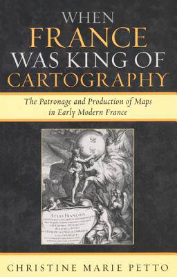
When France Was King of Cartography
The Patronage and Production of Maps in Early Modern France
Christine Marie Petto
€ 103,45
+ 206 punten
Omschrijving
Geographical works, as socially constructed texts, provide a rich source for historians and historians of science investigating patronage, the governmental initiatives and support for science, and the governmental involvement in early modern commerce. Over the course of nearly two centuries (1594-1789), in adopting and adapting maps as tools of statecraft, the Bourbon Dynasty both developed patron-client relations with mapmakers and corporations and created scientific institutions with fundamental geographical goals. Concurrently, France-particularly, Paris-emerged as the dominant center of map production. Individual producers tapped the traditional avenues of patronage, touted the authority of science in their works, and sought both protection and legitimation for their commercial endeavors within the printing industry. Under the reign of the Sun King, these producers of geographical works enjoyed preeminence in the sphere of cartography and employed the familiar rhetoric of image to glorify the reign of Louis XIV. Later, as scientists and scholars embraced Enlightenment empiricism, geographical works adopted the rhetoric of scientific authority and championed the concept that rational thought would lead to progress.
When France Was King of Cartography investigates over a thousand maps and nearly two dozen map producers, analyzes the map as a cultural artifact, map producers as a group, and the array of map viewers over the course of two centuries in France. The book focuses on situated knowledge or "localized" interests reflected in these geographical productions. Through the lens of mapmaking, When France Was King of Cartography examines the relationship between power and the practice of patronage, geography, and commerce in early modern France.Specificaties
Betrokkenen
- Auteur(s):
- Uitgeverij:
Inhoud
- Aantal bladzijden:
- 232
- Taal:
- Engels
- Reeks:
Eigenschappen
- Productcode (EAN):
- 9780739117767
- Verschijningsdatum:
- 16/02/2007
- Uitvoering:
- Paperback
- Formaat:
- Trade paperback (VS)
- Afmetingen:
- 152 mm x 229 mm
- Gewicht:
- 317 g


Alleen bij Standaard Boekhandel
+ 206 punten op je klantenkaart van Standaard Boekhandel
Cadeau

AANGERADEN


Beoordelingen
We publiceren alleen reviews die voldoen aan de voorwaarden voor reviews. Bekijk onze voorwaarden voor reviews.