Bedankt voor het vertrouwen het afgelopen jaar! Om jou te bedanken bieden we GRATIS verzending (in België) aan op alles gedurende de hele maand januari.
- Afhalen na 1 uur in een winkel met voorraad
- In januari gratis thuislevering in België
- Ruim aanbod met 7 miljoen producten
Bedankt voor het vertrouwen het afgelopen jaar! Om jou te bedanken bieden we GRATIS verzending (in België) aan op alles gedurende de hele maand januari.
- Afhalen na 1 uur in een winkel met voorraad
- In januari gratis thuislevering in België
- Ruim aanbod met 7 miljoen producten
Zoeken
€ 242,95
+ 485 punten
Omschrijving
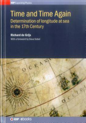
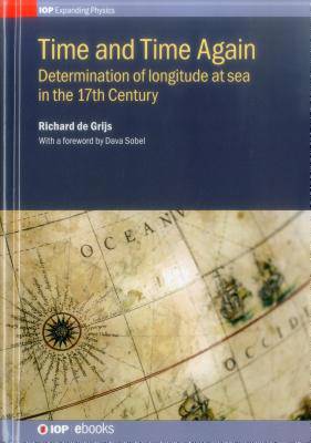
This book explores the role Dutch scholars played in the development of instruments and technology in the 17th Century that would allow sailors to accurately and precisely determine their position, in particular longitude, using the motions of the Sun/stars together with accurate time pieces.
Specificaties
Betrokkenen
- Auteur(s):
- Uitgeverij:
Inhoud
- Aantal bladzijden:
- 368
- Taal:
- Engels
- Reeks:
Eigenschappen
- Productcode (EAN):
- 9780750311953
- Verschijningsdatum:
- 22/11/2017
- Uitvoering:
- Hardcover
- Formaat:
- Genaaid
- Afmetingen:
- 183 mm x 259 mm
- Gewicht:
- 916 g

Alleen bij Standaard Boekhandel
+ 485 punten op je klantenkaart van Standaard Boekhandel
Beoordelingen
We publiceren alleen reviews die voldoen aan de voorwaarden voor reviews. Bekijk onze voorwaarden voor reviews.


