
- Afhalen na 1 uur in een winkel met voorraad
- Gratis thuislevering in België vanaf € 30
- Ruim aanbod met 7 miljoen producten
- Afhalen na 1 uur in een winkel met voorraad
- Gratis thuislevering in België vanaf € 30
- Ruim aanbod met 7 miljoen producten


The Tasman Map
The Biography of a Map Abel Tasman, the Dutch East India Company and the First Dutch Discoveries of Australia
Ian Burnet
Paperback | Engels
€ 59,45
+ 118 punten
Omschrijving
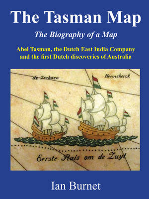
Why is the Tasman Map important? This story of the first Dutch voyages to discover Australia is set against the background of the struggle of the newly formed Dutch Republic to gain its independence from the Kingdom of Spain and the struggle of the Dutch East India Company for trade supremacy in the East Indies against its Portuguese, Spanish, and English rivals. Over a period of only forty years (from 1606 to 1644) and based on sixteen separate discoveries, the first map of Australia took shape. The Tasman Map shows a recognizable outline of the north, west, and south coasts of Australia that was not to change for another 125 years, until the British explorer James Cook charted the east coast in 1770. It was in 1925 and 1933 that the Mitchell Library in Sydney, Australia acquired both the Tasman Huydecoper Journal and the Tasman Bonaparte Map. The story of how the library managed to acquire these treasures of Dutch exploration and cartography will bring new recognition to these icons of both Dutch and Australian history.
Specificaties
Betrokkenen
- Auteur(s):
- Uitgeverij:
Inhoud
- Aantal bladzijden:
- 176
- Taal:
- Engels
Eigenschappen
- Productcode (EAN):
- 9780648446651
- Verschijningsdatum:
- 1/01/2020
- Uitvoering:
- Paperback
- Formaat:
- Trade paperback (VS)
- Afmetingen:
- 184 mm x 235 mm


Alleen bij Standaard Boekhandel
+ 118 punten op je klantenkaart van Standaard Boekhandel
AANGERADEN


Beoordelingen
We publiceren alleen reviews die voldoen aan de voorwaarden voor reviews. Bekijk onze voorwaarden voor reviews.