- Afhalen na 1 uur in een winkel met voorraad
- Gratis thuislevering in België vanaf € 30
- Ruim aanbod met 7 miljoen producten
- Afhalen na 1 uur in een winkel met voorraad
- Gratis thuislevering in België vanaf € 30
- Ruim aanbod met 7 miljoen producten
Zoeken
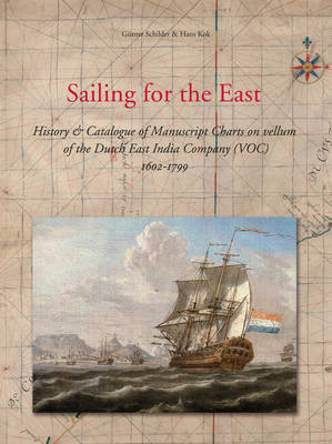
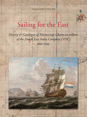
Sailing for the East
History and Catalogue of Manuscript Charts on Vellum of the Dutch East India Company (Voc), 1602-1799
Günter Schilder, Hans Kok
€ 390,95
+ 781 punten
Omschrijving
The Vereenigde Oostindische Compagnie (Dutch East India Company) was for a period of 200 years responsible for the navigation material for the journey between the Netherlands and the Far East and the inter-Asian trade. In this book with the help of recovered archive materials a never published before overview is given of chart material that was used on a VOC-ship.
All navigation charts of the VOC in the 17th and 18th century, drawn on vellum (of which many were traced in foreign collections), are described and analysed in an illustrated cartobibliography. In a supplement extracts of the 'groot-journalen' of the 'Kamer Amsterdam' are published. These give an unique view of the total expenses of the VOC on navigation. The extensive introduction gives more information on the history of the VOC, the chart makers, the routes, the navigation and the instruments. Inlcudes CD-rom with appendices.
Volume 10 of the Utrecht Studies of the History of Cartography (EXPLOKART).
Specificaties
Betrokkenen
- Auteur(s):
- Uitgeverij:
Inhoud
- Aantal bladzijden:
- 708
- Taal:
- Engels
- Reeks:
- Reeksnummer:
- nr. 10
Eigenschappen
- Productcode (EAN):
- 9789061942603
- Verschijningsdatum:
- 1/01/2010
- Uitvoering:
- Hardcover
- Formaat:
- Genaaid
- Afmetingen:
- 240 mm x 320 mm
- Gewicht:
- 3899 g

Alleen bij Standaard Boekhandel
+ 781 punten op je klantenkaart van Standaard Boekhandel
Beoordelingen
We publiceren alleen reviews die voldoen aan de voorwaarden voor reviews. Bekijk onze voorwaarden voor reviews.


