
Bedankt voor het vertrouwen het afgelopen jaar! Om jou te bedanken bieden we GRATIS verzending (in België) aan op alles gedurende de hele maand januari.
- Afhalen na 1 uur in een winkel met voorraad
- In januari gratis thuislevering in België
- Ruim aanbod met 7 miljoen producten
Bedankt voor het vertrouwen het afgelopen jaar! Om jou te bedanken bieden we GRATIS verzending (in België) aan op alles gedurende de hele maand januari.
- Afhalen na 1 uur in een winkel met voorraad
- In januari gratis thuislevering in België
- Ruim aanbod met 7 miljoen producten


Omschrijving
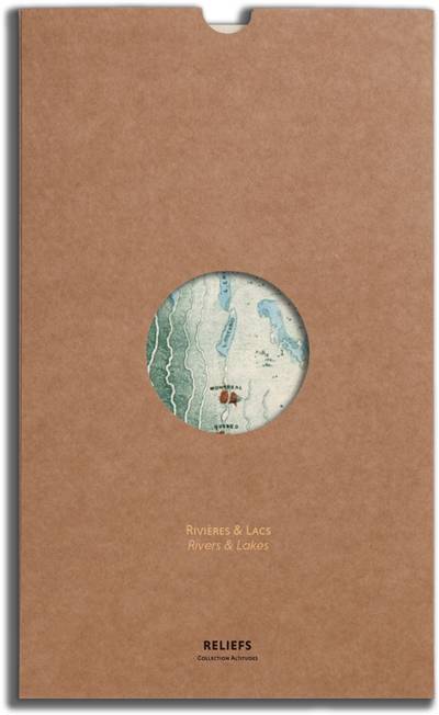
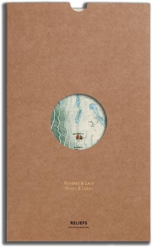
Rivières & Lacs
Cette gravure colorée a la main, dessinée par le cartographe John Emslie, est issue de l'ouvrage Geological diagrams, publié en 1851 par l'éditeur britannique James Reynolds. Dans une Angleterre industrielle passionnée par le progrès des sciences, ce « plan panoramique » présente une vue comparative des principaux fleuves et lacs du monde : classés par continents ou par hémisphère, Danube, Rhin, Nil ou Amazone d'une part, Mer Morte, Mer Caspienne, ou Léman d'autre part, sont ainsi places cote a cote afin que nous puissions mieux appréhender leurs tailles et longueurs respectives.
Rivers & lakes
This hand-colored engraving, drawn by cartographer John Emslie, comes from the book Geological diagrams, published in 1851 by the British publisher James Reynolds. In an industrial England impassioned by the progress of science, this « panoramic plan » presents a comparative view of the main rivers and lakes of the world : classified by continents or hemisphere, the Danube, Rhine, Nile or Amazon on the one hand, the Dead Sea, Caspian Sea, or Lake Leman on the other, are thus placed side by side so that we can better understand their respective sizes and lengths.
Specificaties
Betrokkenen
- Auteur(s):
- Uitgeverij:
Inhoud
- Taal:
- Frans, Engels
Eigenschappen
- Productcode (EAN):
- 9791096554522
- Verschijningsdatum:
- 7/11/2019
- Afmetingen:
- 230 mm x 350 mm
- Gewicht:
- 88 g


Alleen bij Standaard Boekhandel
+ 36 punten op je klantenkaart van Standaard Boekhandel
SOLDEN


Beoordelingen
We publiceren alleen reviews die voldoen aan de voorwaarden voor reviews. Bekijk onze voorwaarden voor reviews.