
Bedankt voor het vertrouwen het afgelopen jaar! Om jou te bedanken bieden we GRATIS verzending (in België) aan op alles gedurende de hele maand januari.
- Afhalen na 1 uur in een winkel met voorraad
- In januari gratis thuislevering in België
- Ruim aanbod met 7 miljoen producten
Bedankt voor het vertrouwen het afgelopen jaar! Om jou te bedanken bieden we GRATIS verzending (in België) aan op alles gedurende de hele maand januari.
- Afhalen na 1 uur in een winkel met voorraad
- In januari gratis thuislevering in België
- Ruim aanbod met 7 miljoen producten


Omschrijving
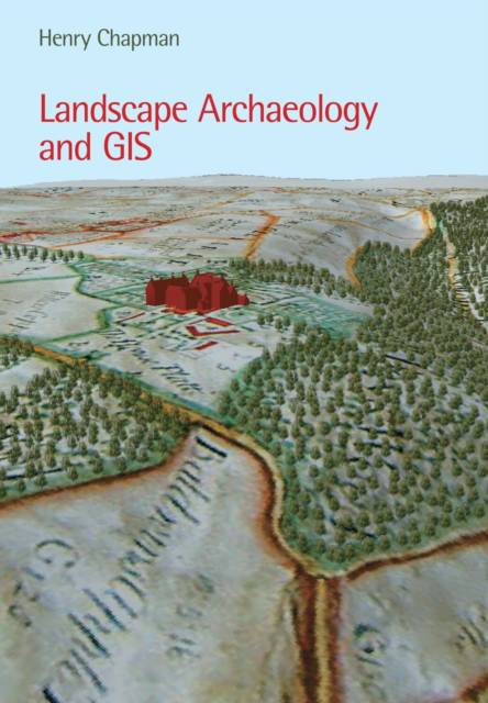
Landscape Archaeology and GIS examines the ways in which Geographical Information Systems can be used to explore archaeological landscapes, and summarizes the most appropriate methods to use. It is structured around principal themes in landscape archaeology, and integrates desk-based assessment, data collection, data modeling, and landscape analysis, right through to archiving and publication. This is the first book on GIS to focus specifically on landscape archaeology that is accessible to a wide archaeological readership. It explores the applications of GIS to a wide variety of archaeological evidence including maps, aerial photographs, and earthworks. The work is well-illustrated throughout with digital maps and models being used to support case studies, as well as for suggesting new hypotheses relevant to this discipline.
Specificaties
Betrokkenen
- Auteur(s):
- Uitgeverij:
Inhoud
- Aantal bladzijden:
- 240
- Taal:
- Engels
Eigenschappen
- Productcode (EAN):
- 9780752436036
- Verschijningsdatum:
- 1/10/2006
- Uitvoering:
- Paperback
- Formaat:
- Trade paperback (VS)
- Afmetingen:
- 174 mm x 245 mm
- Gewicht:
- 526 g


Alleen bij Standaard Boekhandel
+ 62 punten op je klantenkaart van Standaard Boekhandel
SOLDEN


Beoordelingen
We publiceren alleen reviews die voldoen aan de voorwaarden voor reviews. Bekijk onze voorwaarden voor reviews.