Bedankt voor het vertrouwen het afgelopen jaar! Om jou te bedanken bieden we GRATIS verzending (in België) aan op alles gedurende de hele maand januari.
- Afhalen na 1 uur in een winkel met voorraad
- In januari gratis thuislevering in België
- Ruim aanbod met 7 miljoen producten
Bedankt voor het vertrouwen het afgelopen jaar! Om jou te bedanken bieden we GRATIS verzending (in België) aan op alles gedurende de hele maand januari.
- Afhalen na 1 uur in een winkel met voorraad
- In januari gratis thuislevering in België
- Ruim aanbod met 7 miljoen producten
Zoeken
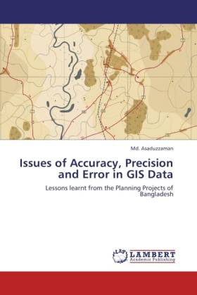
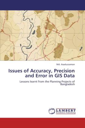
Issues of Accuracy, Precision and Error in GIS Data
Lessons learnt from the Planning Projects of Bangladesh
Md. Asaduzzaman
Paperback | Engels
€ 80,45
+ 160 punten
Omschrijving
Prior to GIS (geographic information system), maps were used mainly for strategic planning. As a result, high spatial accuracy was not required. So, errors in spatially referenced data were ignored or considered acceptable. The situation changed today. Accuracy is a great matter of concern for not only increase of land s monetary value but also for decision making and so on. In Bangladesh, most of the physical planning projects are using GIS for preparing map and making decision but a lion s share of the data are inaccurate having spatial and attribute error. The more accurate a dataset will be, the more perfect and precise the outcome will be. As imperfection severely limits the usefulness of a dataset especially for GIS, users as well as the specialists need to be very careful regarding errors and managing them. This work is based on some observations especially, some GIS data that the planning authorities of Bangladesh have prepared. Bangladesh is using GIS until very recently and thus, there is a huge scope to improve its data and database.
Specificaties
Betrokkenen
- Auteur(s):
- Uitgeverij:
Inhoud
- Aantal bladzijden:
- 140
- Taal:
- Engels
Eigenschappen
- Productcode (EAN):
- 9783846534748
- Verschijningsdatum:
- 18/10/2011
- Uitvoering:
- Paperback
- Afmetingen:
- 152 mm x 229 mm
- Gewicht:
- 202 g

Alleen bij Standaard Boekhandel
+ 160 punten op je klantenkaart van Standaard Boekhandel
Beoordelingen
We publiceren alleen reviews die voldoen aan de voorwaarden voor reviews. Bekijk onze voorwaarden voor reviews.


