
Door een staking bij bpost kan je online bestelling op dit moment iets langer onderweg zijn dan voorzien. Dringend iets nodig? Onze winkels ontvangen jou met open armen!
- Afhalen na 1 uur in een winkel met voorraad
- Gratis thuislevering in België vanaf € 30
- Ruim aanbod met 7 miljoen producten
Door een staking bij bpost kan je online bestelling op dit moment iets langer onderweg zijn dan voorzien. Dringend iets nodig? Onze winkels ontvangen jou met open armen!
- Afhalen na 1 uur in een winkel met voorraad
- Gratis thuislevering in België vanaf € 30
- Ruim aanbod met 7 miljoen producten


€ 25,45
+ 50 punten
Omschrijving
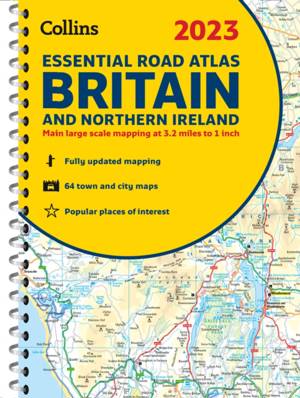
This A4 road atlas with popular lie-flat spiral binding features clear, detailed road mapping, at a scale of 3.2 miles to 1 inch (1:200,000) for England, Wales and Southern Scotland and at 4.2 miles to 1 inch (1:266,000) in Northern Scotland, with land height shown by attractive layer coloring. Main features
- Route planning section including maps at a scale of 22 miles to 1 inch for long distance route planning, motorway services information and a handy distance calculator chart.
- 26 urban area approach maps at a larger scale which clearly show the best routes through and into the busiest built-up-areas.
- 64 street maps focused on town centers showing places of interest, car park locations and one-way streets. All the street maps are fully indexed.
- Over 30 categories of places of interest including castles, theme parks, sports venues, universities, mountain bike trails and surfing beaches.
- The top 1000 most visited places of interest are indexed with full postcodes to aid integration with satnav systems.
- Easy to use, clear road maps at a scale of 3.2 miles to 1 inch (1:200,000) for England, Wales and Southern Scotland and at 4.2 miles to 1 inch (1:266,000) in Northern Scotland. This is the ideal purchase for drivers, navigators and route planners who want the very best road atlas of Britain in an A4 format.
Specificaties
Betrokkenen
- Auteur(s):
- Uitgeverij:
Inhoud
- Aantal bladzijden:
- 336
- Taal:
- Engels
- Reeks:
Eigenschappen
- Productcode (EAN):
- 9780008447823
- Verschijningsdatum:
- 1/11/2022
- Uitvoering:
- Met spiraalrug
- Afmetingen:
- 210 mm x 297 mm
- Gewicht:
- 1006 g


Alleen bij Standaard Boekhandel
+ 50 punten op je klantenkaart van Standaard Boekhandel
MUST-HAVES

AANGERADEN

MOEDERDAG ACTIE


Beoordelingen
We publiceren alleen reviews die voldoen aan de voorwaarden voor reviews. Bekijk onze voorwaarden voor reviews.